The Byzantine fortress of Apalirou
The most important Byzantine fortress of Naxos is located in the southwest of the island between the small village of Sangrí and the bay of Agiassós. The large castle complex occupies the top of the 450 m high mountain of Apalírou and overlooks one of the largest plains of Naxos. The mountain and the castle got their name from the buckthorn (Rhamnus lycioides, gr. apaliriá), which can still be found here today. Today it grows only as a low shrub; in the past, however, it is said that there were whole forests of large trees of the species on Naxos, and the very durable wood was used for roofs and other constructions.
To visit the fortress of Apalírou, one passes Sangrí (coming from the Chóra) and follows the road to Agiassós to the south. After about 1.5 kilometers, one turns left onto a small dirt road and follow it to its end. There one starts the ascent by a sign “Kastro Apalírou”, which stands near the house at the foot of the slope.
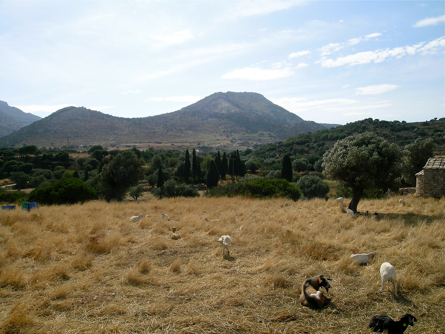
view of the mountain of Apalírou from the asphalt road
The path that leads up to the fortress is not very obvious. On the whole, you have to climb diagonally to the right steeply up the slope. It’s best to stick as much as possible to the largest goat path. First one passes through sparse vegetation, then through an open maquis of Phoenicean juniper; in some places there are also small groups of Kermes oak trees.
The first part of the hill is covered by an open maquis, mainly of Phoenicean juniper.
On the first hilltop, the view opens up to the uninhabited valley in the east and to the top of the mountain with the fortress. The path runs southwards over the saddle and then continues diagonally up the steep slope of the mountain. Again, one should try to stay on the widest path, because the steep slope below the fortress is covered in gravel and therefore slippery.
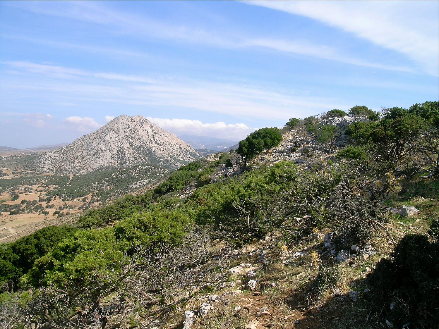
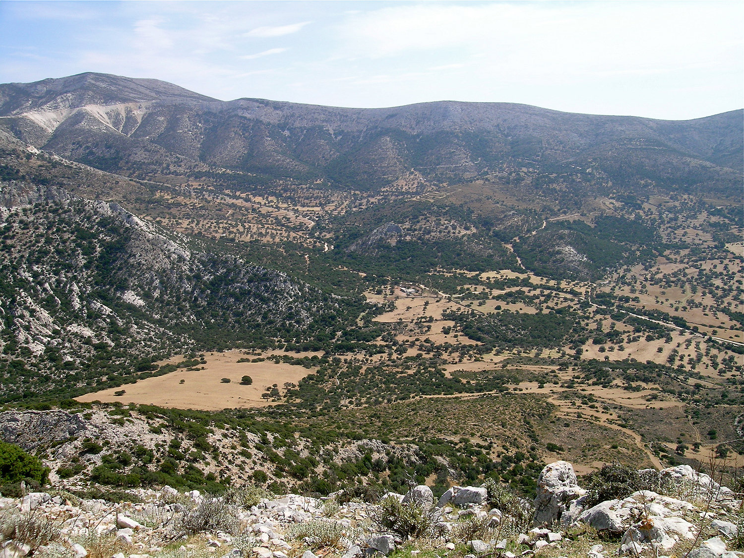
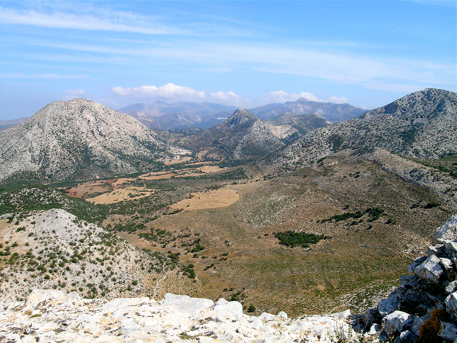
View into the barren valley on the eastern side of the mountain of Apalírou; in the background mount Zeus
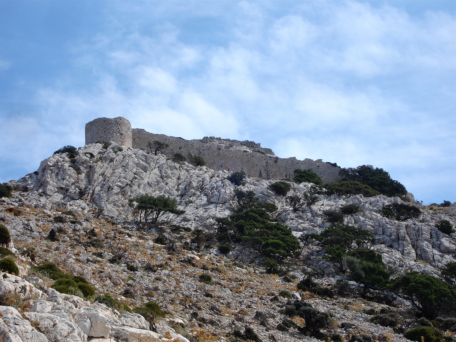
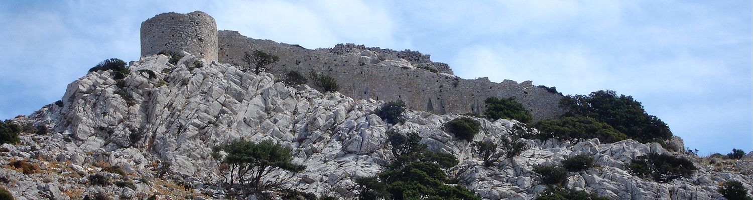
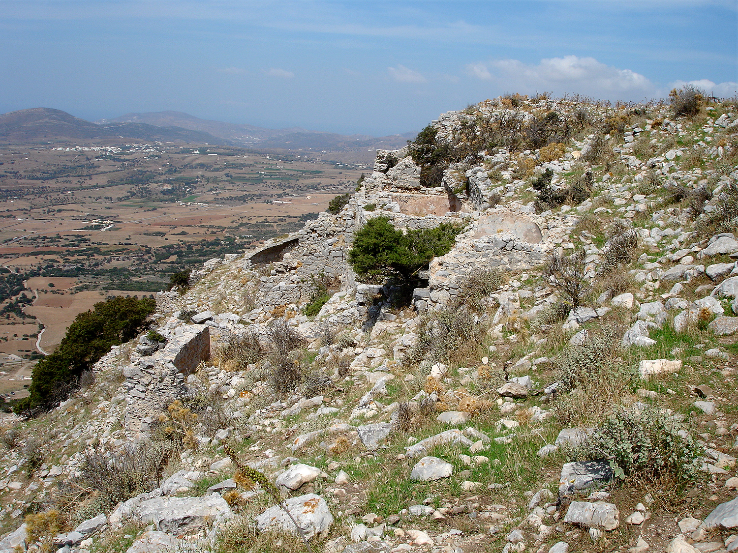
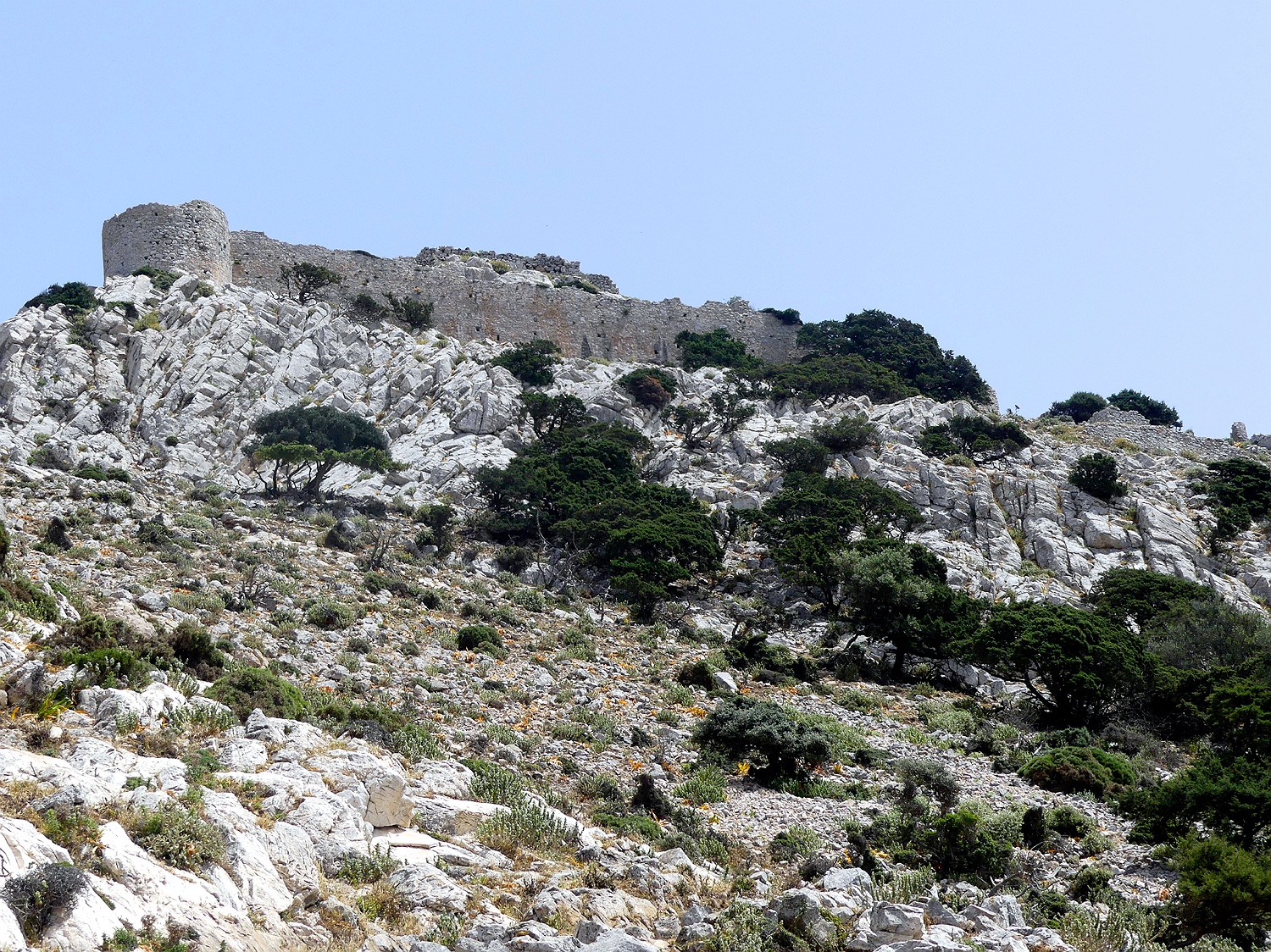
On the top the view opens towards the fortress of Apalírou, which is proudly perched on the summit.
The slope below the fortress is very steep and rather difficult to ascend. It is littered with rubble with lots of potsherds. In the Middle Ages, the inhabitants of Naxos had given up the harbour towns (like the millennia-old settlement in the Chóra) because of the continuous threat through pirate attacks, and retreated to the sheltered interior of the island. During these times the largest settlement on the island was here in Apalírou. The inhabitants cultivated the large fertile plain below the mountain.
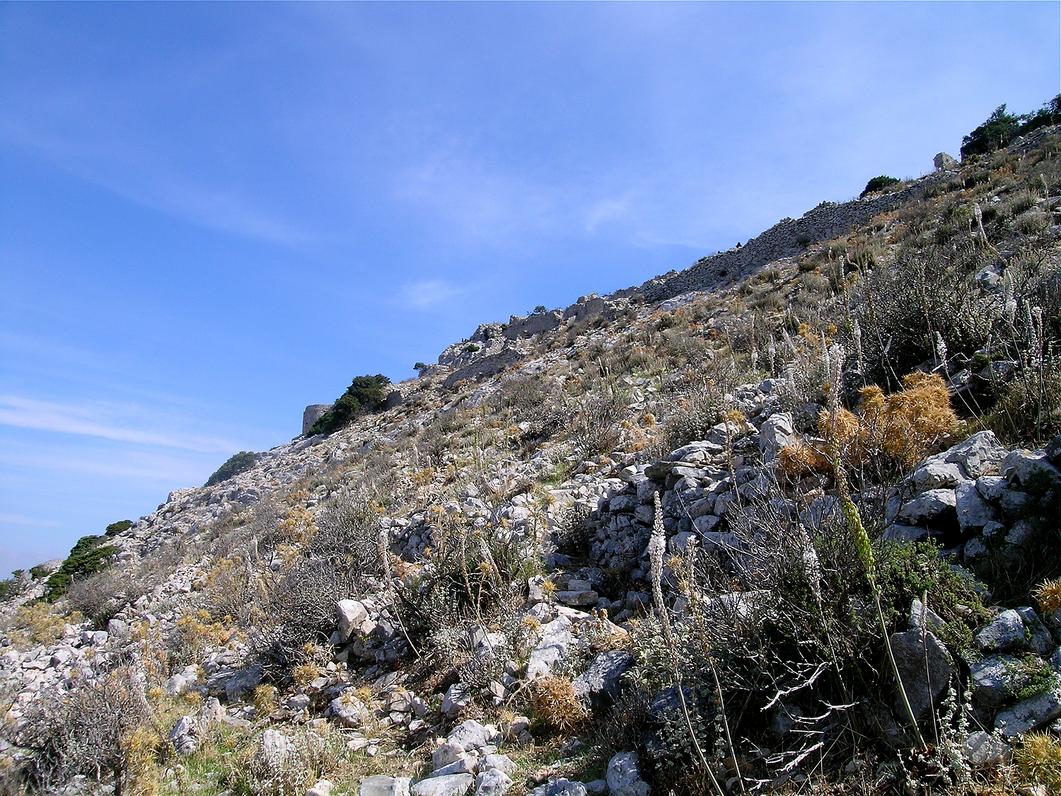
During the Middle Ages the largest settlement on the island lay on the mountain of Apalírou below the fortress. The steep slope below the castle is covered with rubble.
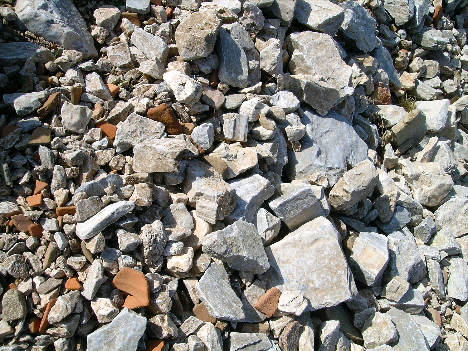
Lots of potsherds in the rubble show the that this area was inhabited and used over a long time.
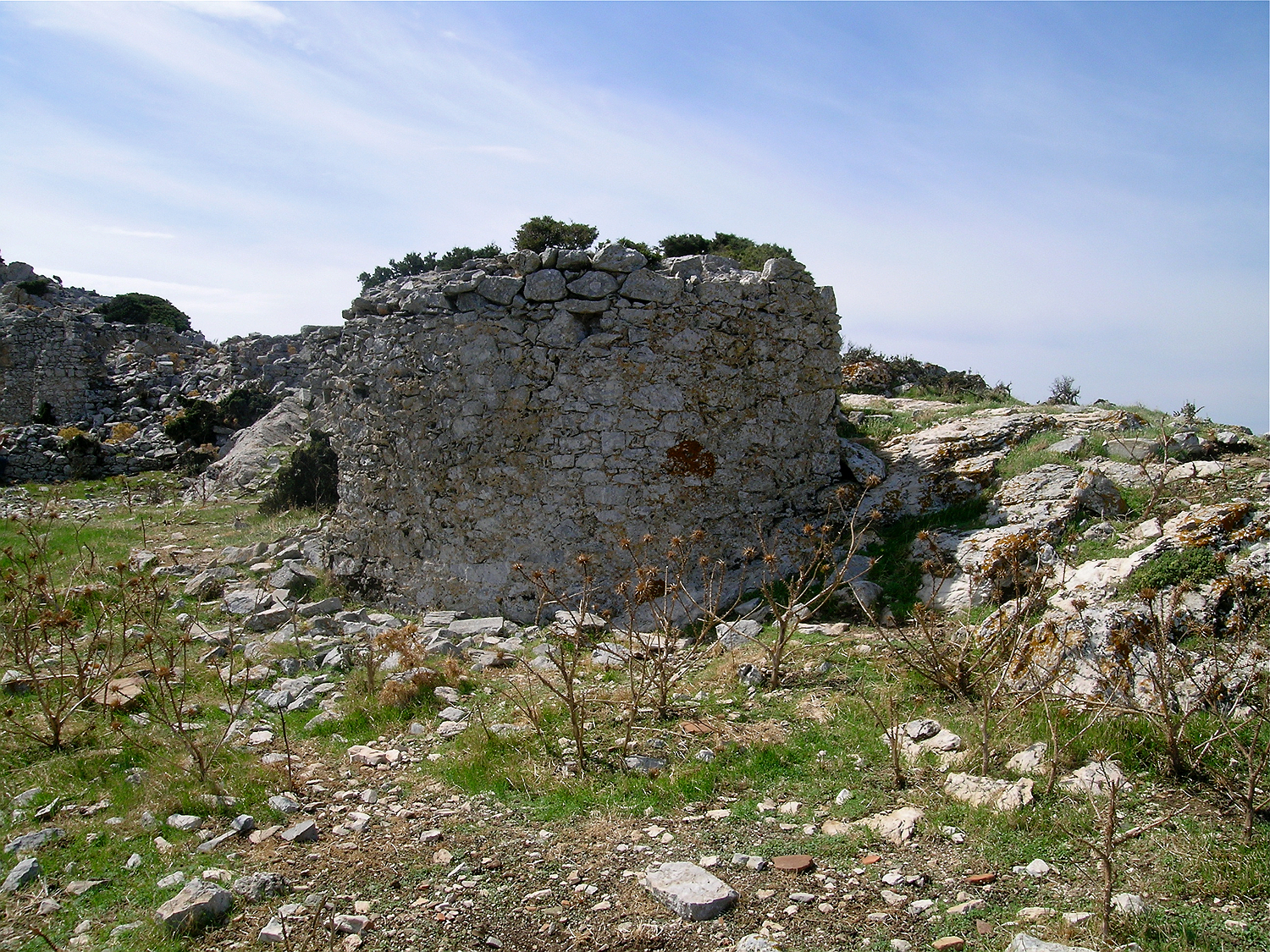
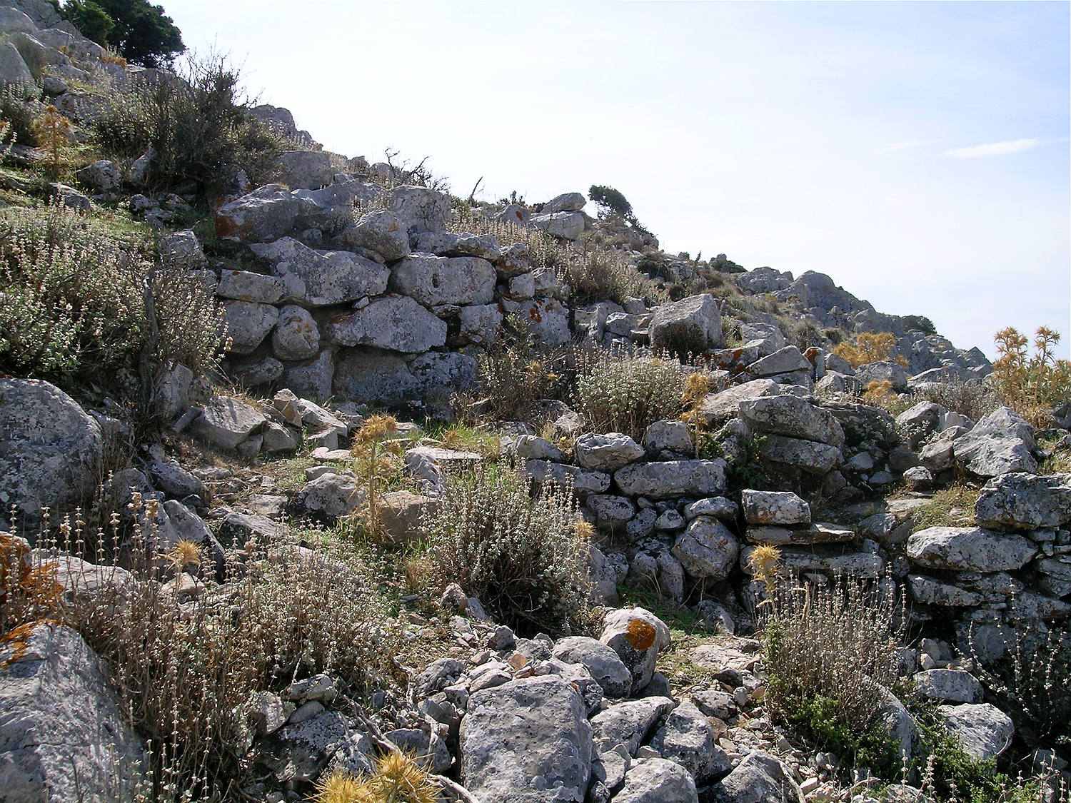
Quite high up on the slope, the path turns back and runs now, rather indistinctly, diagonally to the left, that is towards to the northern part of the castle, where most of the better preserved buildings lie. Approaching from below you can see the impressive defensive wall of several meter height which in its northwestern part is largely intact. In this area there are two walls that are located directly above each other. In this area the foundation of a large round tower belonging to the outer wall has been preserved. Traces of other towers can also be detected. Within the area of the fortress lies a whole series of buildings and many large and small cisterns. An accurate mapping of Castle of Apalírou has been carried out since 2010 by archaeologists from the Universities of Oslo and Newcastle. Within the perimeter walls, especially on the west side of the hill, a large number of buildings (at least 75 houses) were found, a total of 40 to 50 cisterns, two church complexes and a monastery. The houses had a sewer system and were sometimes two storeys high. The fortress of Apaírou is by far the largest such complex of its time in the Cyclades.
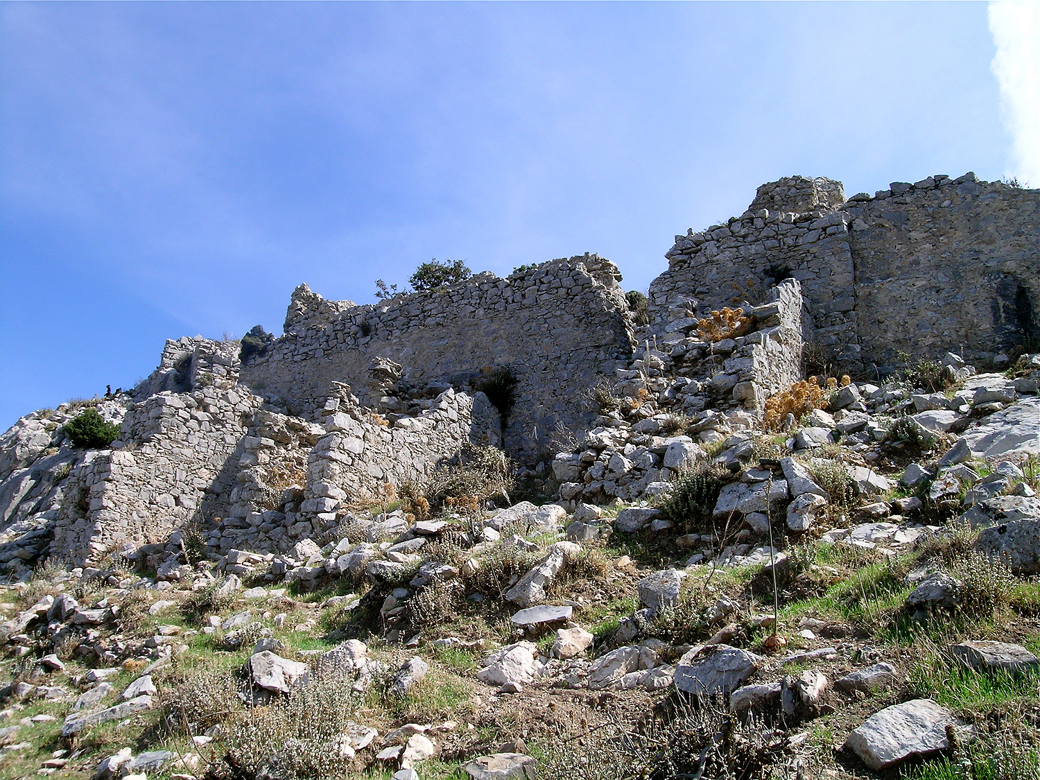
Directly above the lowest defensive wall lies this second wall, which is reinforced with bastions. Behind it lie several buildings.
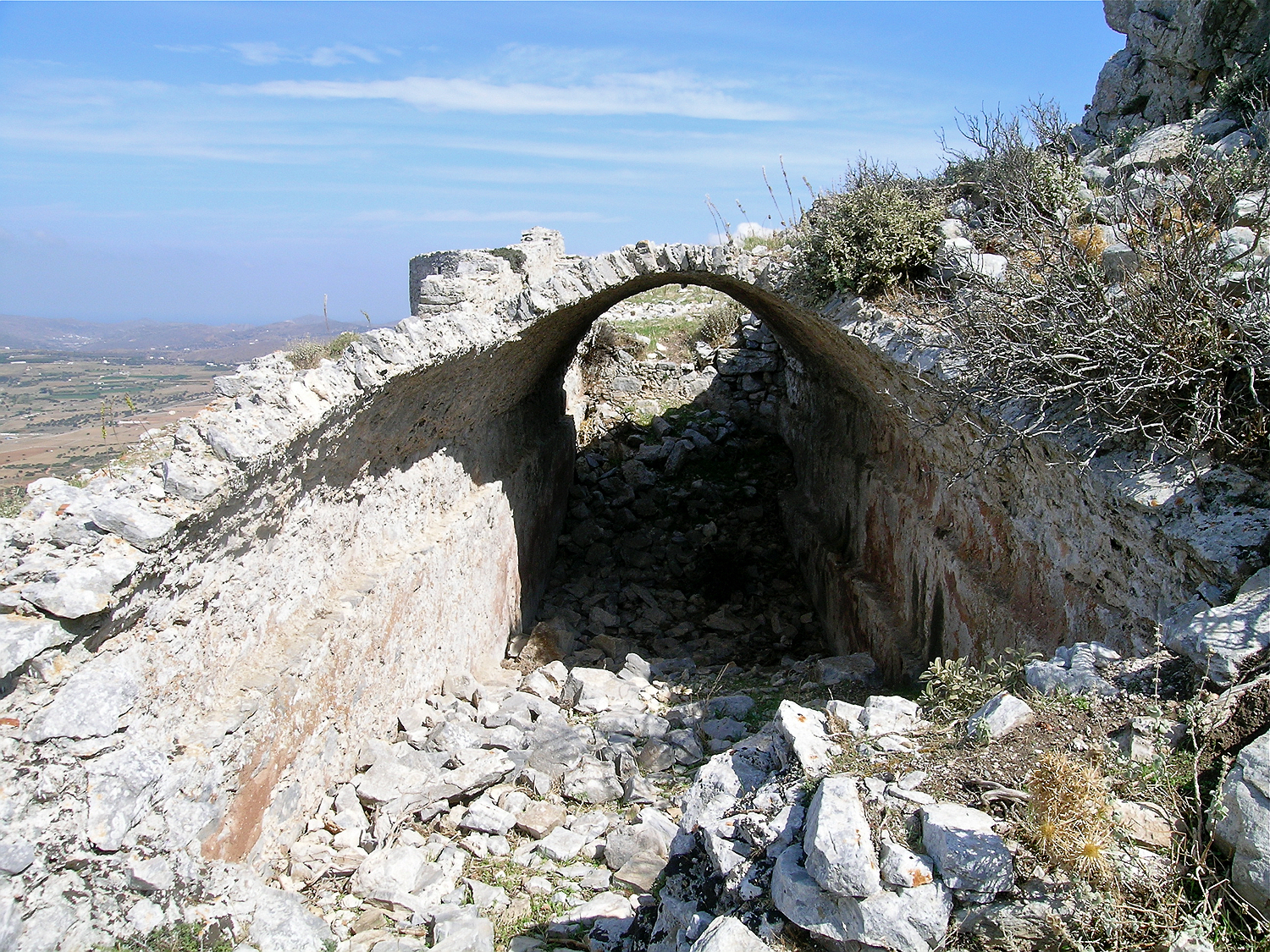
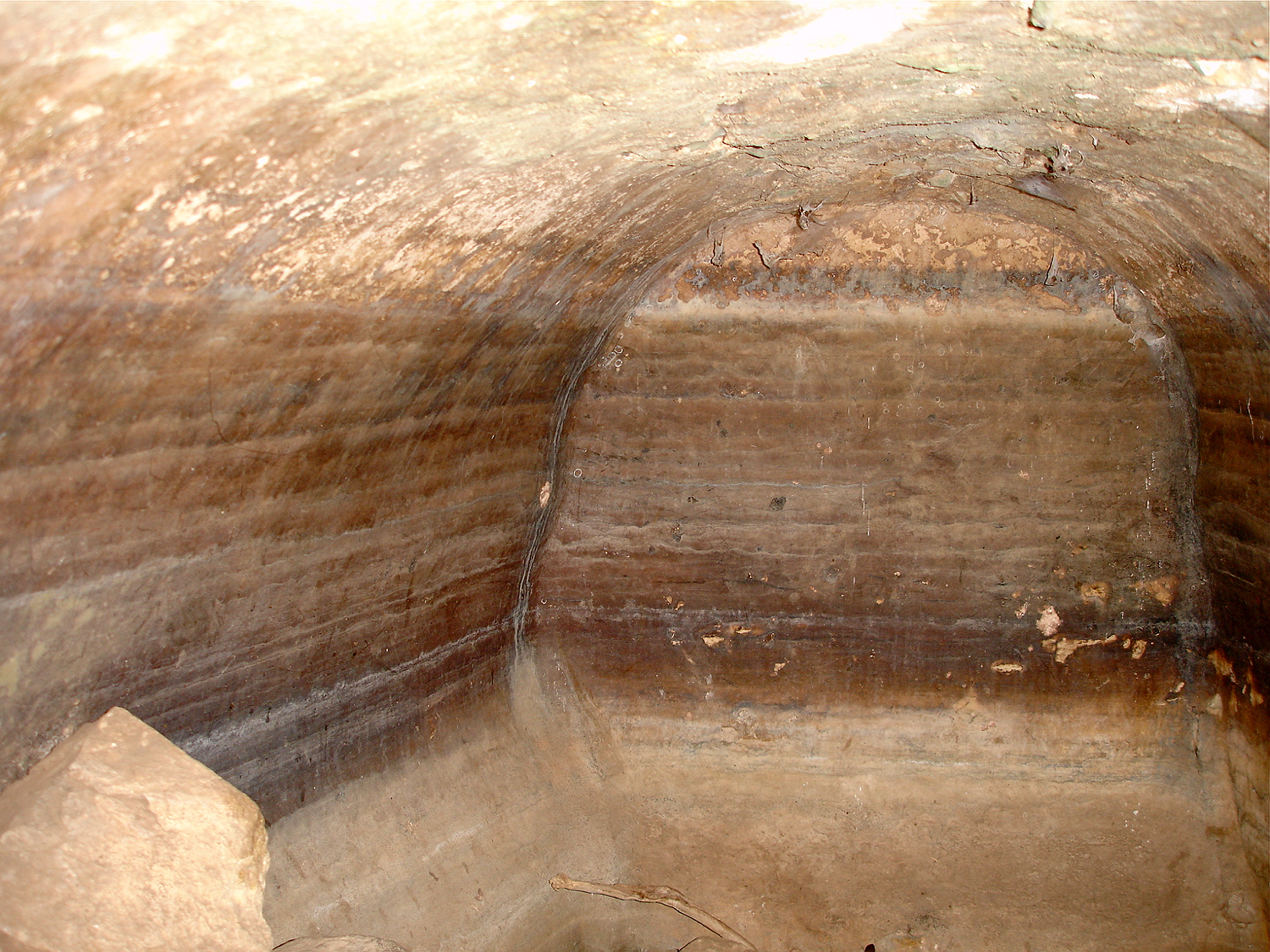
This large, well-preserved cistern is built from raw stones in the shape of a barrel vault. From the inside the walls are plastered.
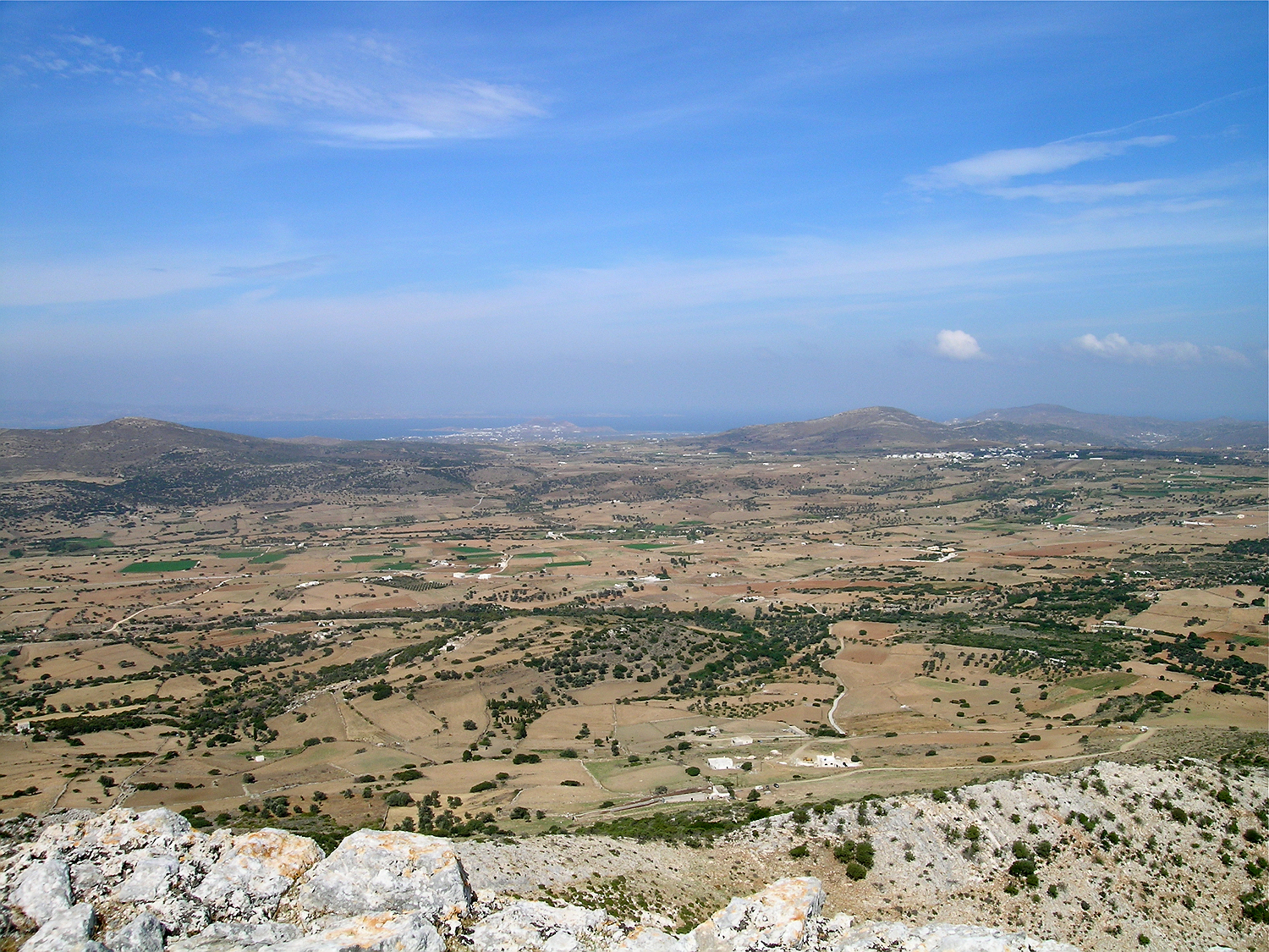
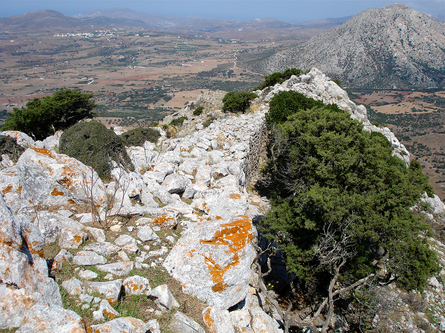
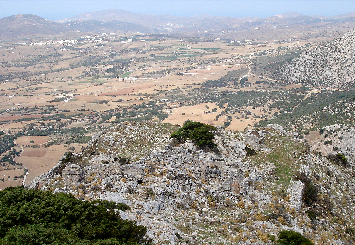
Looking towards the northwest over the wide plain which ist still today cultivated with grain. Approximately in the middle of the picture lies the Temple of Demeter, to the right the village of Sangrí. In the background the villages of Ágios Prokópios and Ágia Ánna are visible.
Looking southwest towards Kastráki
Continuing further up into the northeastern area of the fortress, one comes across a series of small cisterns, several of which are built directly adjacent to the defensive wall. Here lies also the second larger building complex with a church and some smaller buildings around it. The church was dedicated to St. George and had two naves.
A well-preserved cistern lies directly behind the defensive wall.
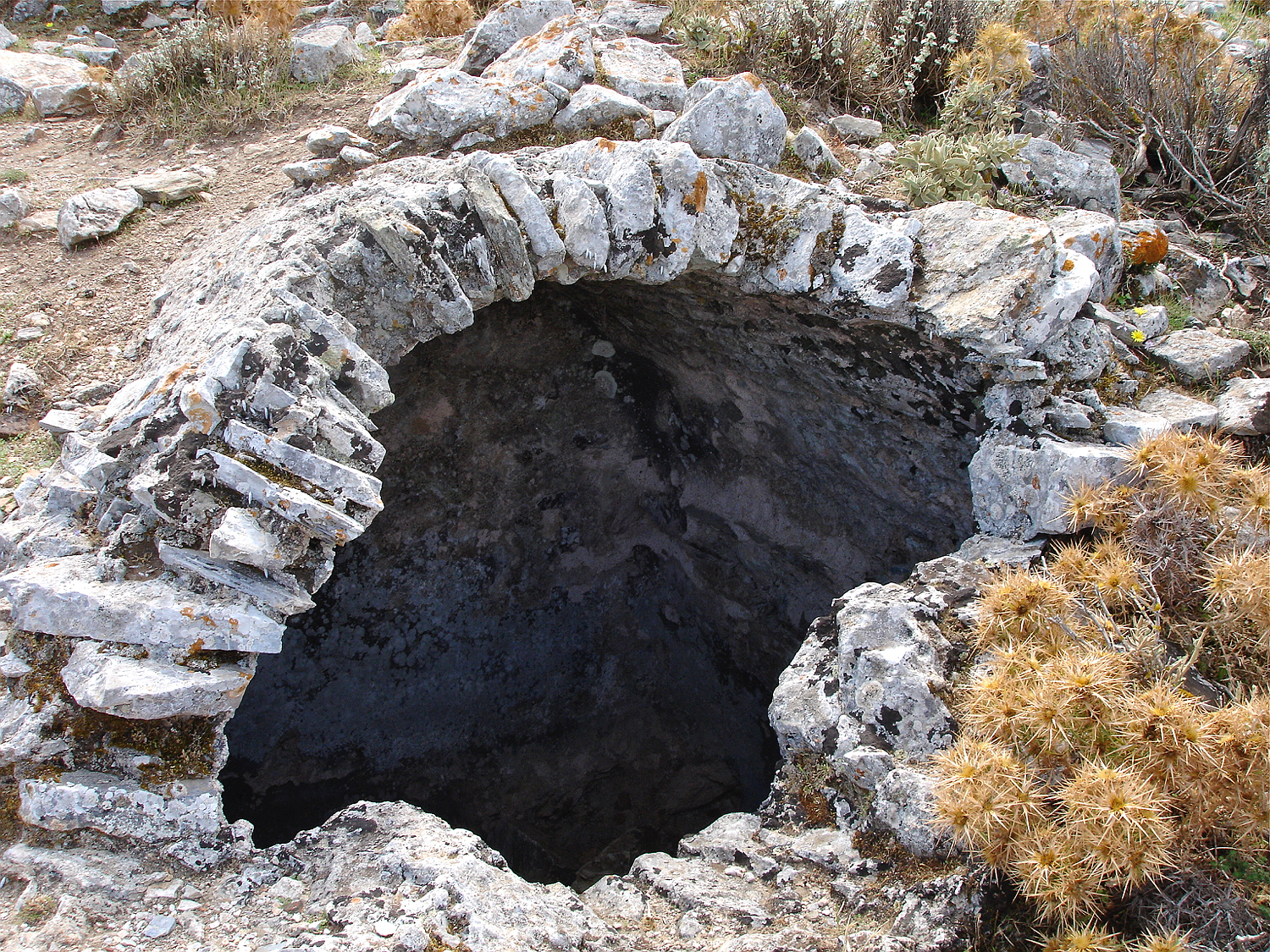
This strange, almost round building was also a cistern.
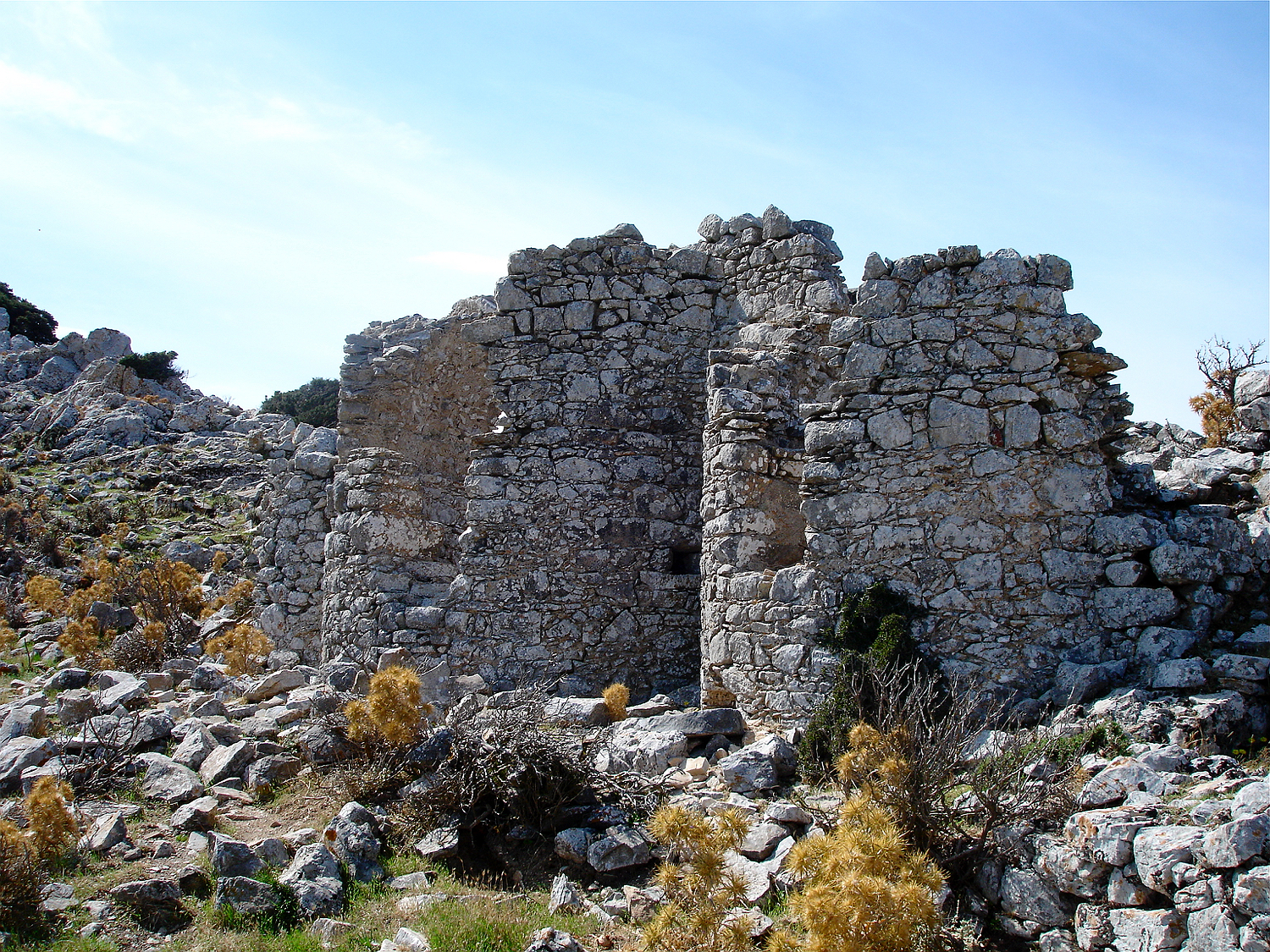
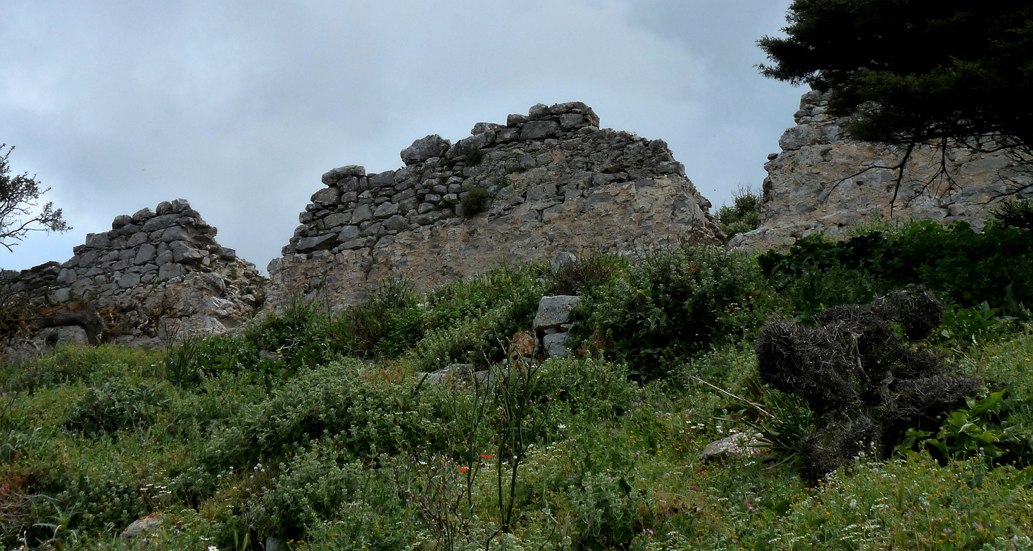
In the northern part of the fortress lie the remains of a church and some other buildings next to it.
The church building is quite well preserved.
the apse
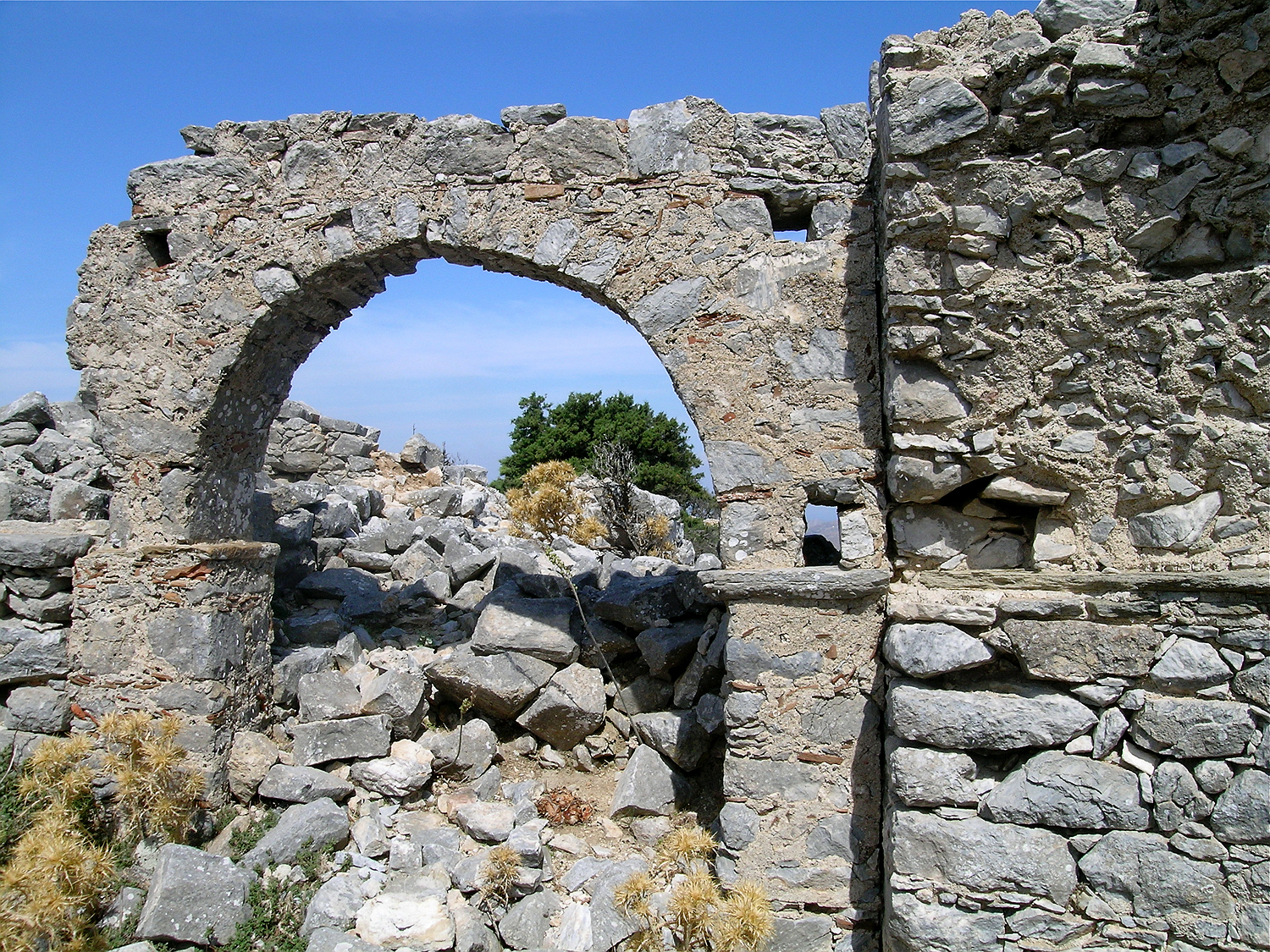
As so often the case the church is built in a rather careless way. For the construction mainly the gray marble found right in the area was used. Only the ledges below the arches were made with special slate plates that have been transported here from somewhere else.
Many potsherds have been built into the walls – an indication that human were living here already before the construction of the churches in the early Middle Ages.
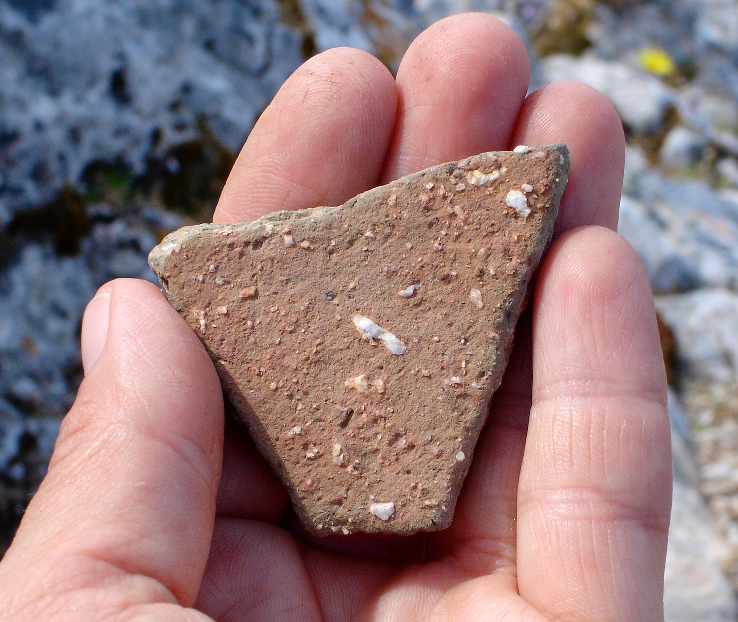
The potsherds lying around in the area are mostly of poorly sifted, coarse clay, suggesting that they are quite old.
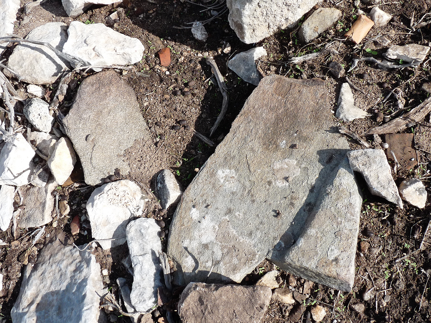
In many places one finds slate slabs, which were transported here on purpose, as slate does not occur here naturally. Maybe they were used as roof tiles.
Walking along the western slope towards the southern end of the mountain summit one encounters the remains of a few more houses and walls.
On the western side of the fortress many building remains are visible.
remains of a house
and another one
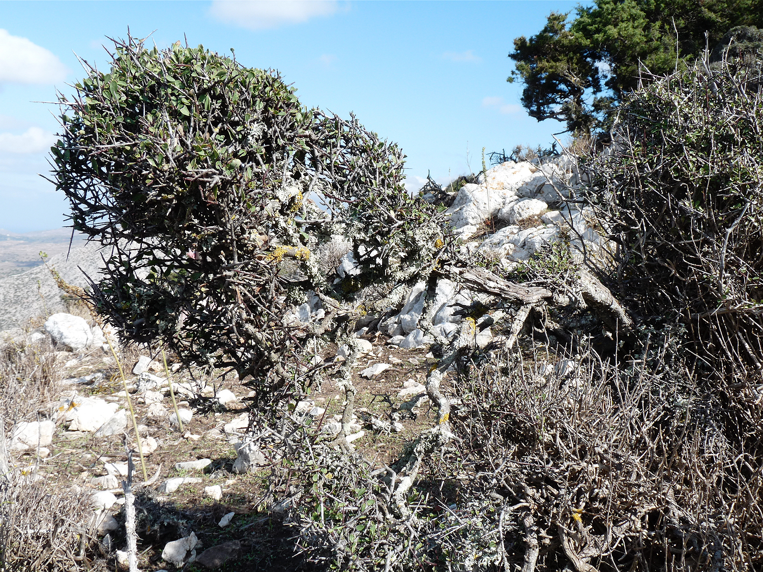
In the area of the fortress grow many buckthorns, which gave the mountain its name: Rhamnus lycioides is called apaliriá in Greek.
View from the south along the western border of the fortress. One can see the many buildings that lie here.
In many places there are walls of stones that are made without mortar or plaster.
At the southern tip of the mountain lie beautiful rock formations of white marble with protected natural terraces in between which are already covered in green. At the summit we again find the remains of a cistern; another cistern is incorporated into the ground. Here one has a great view not only over the plain to the west, but also over the smaller plain of Marathós nestling in the mountains to the east. To the south one can see the bay of Agiassós in the distance.
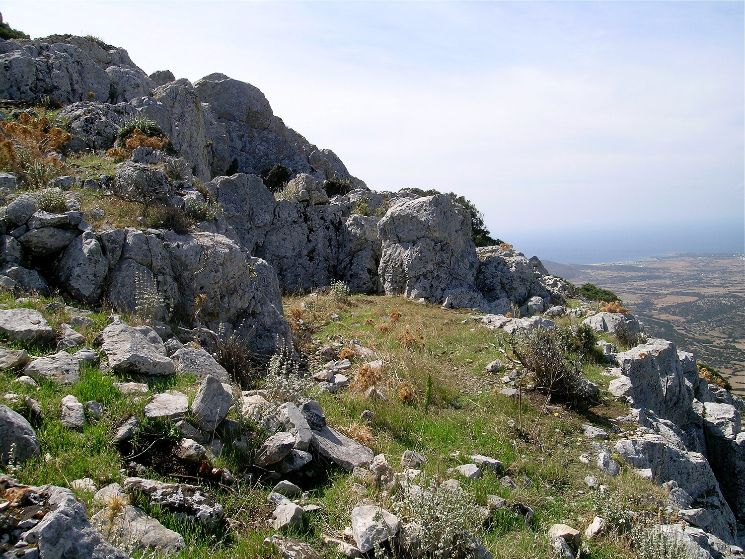
In the southern part of the fortress beautiful green terraces are naturally embedded in between the marble rocks.
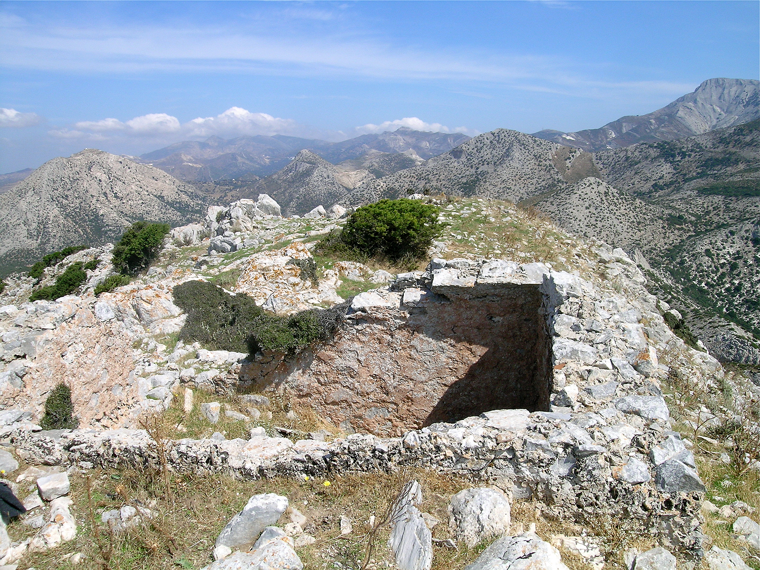
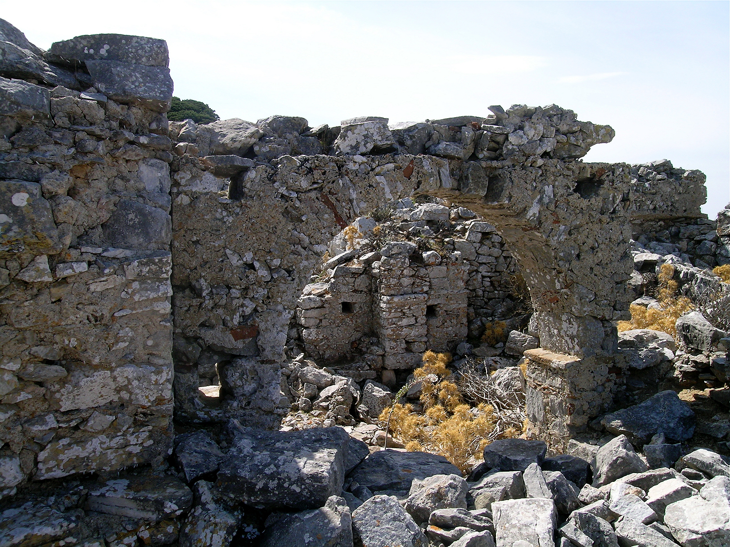
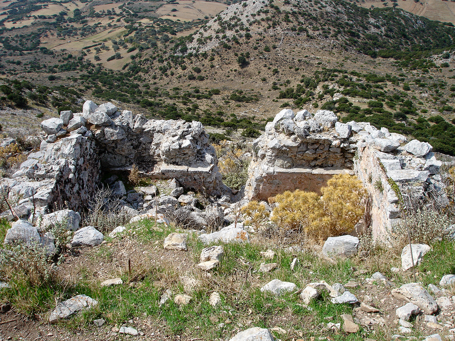
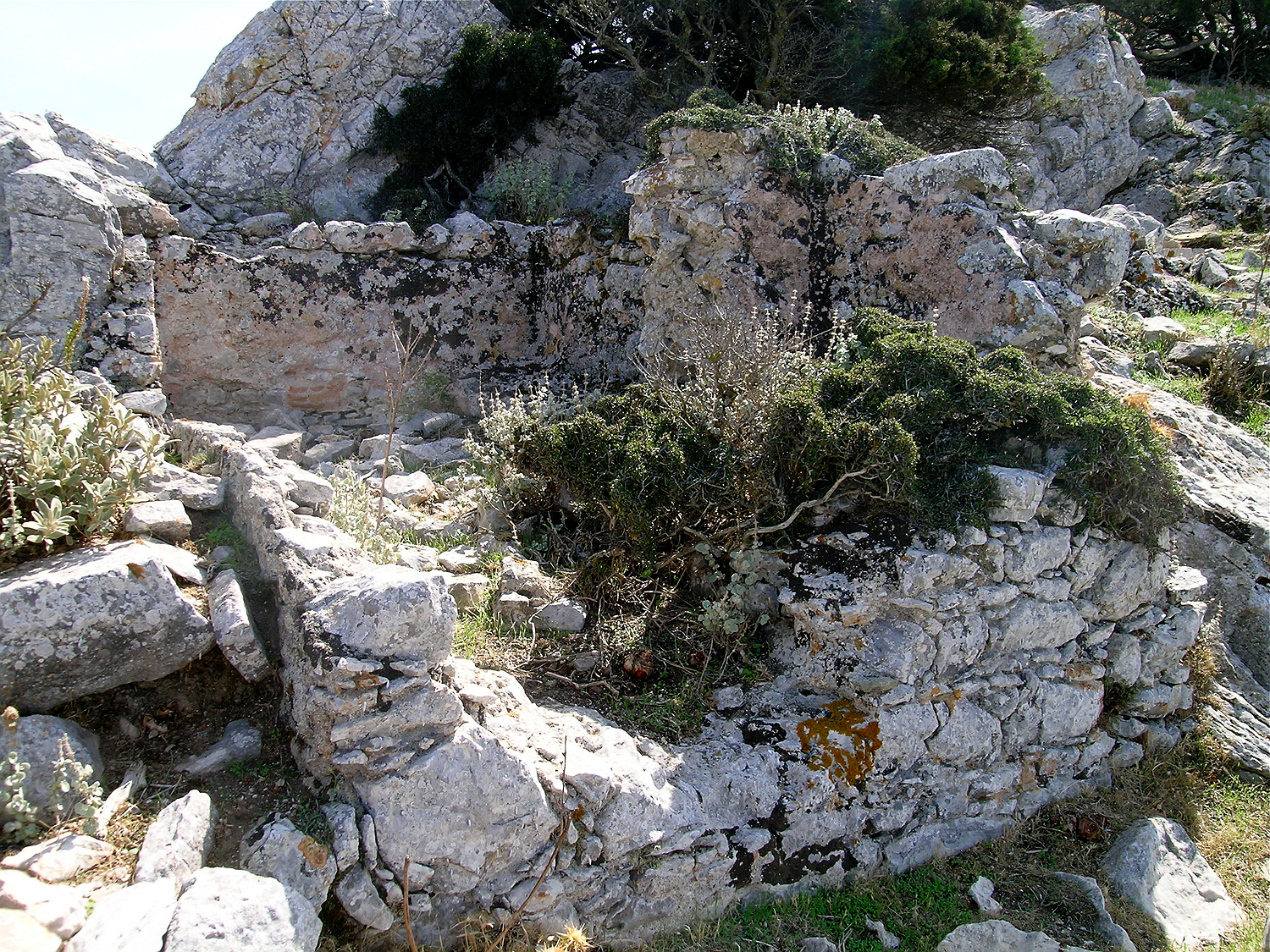
At the southern end of the fortress lies a half collapsed building. As can be seen from the reddish plaster, this is also a cistern.
another cistern
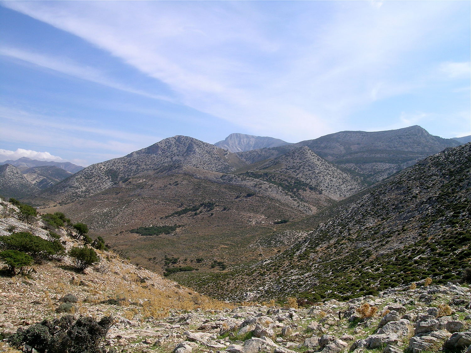
Looking southeast over the valley of Marathós
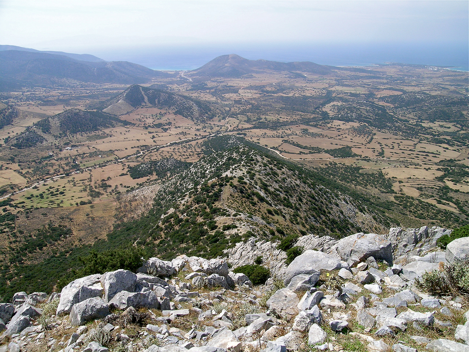
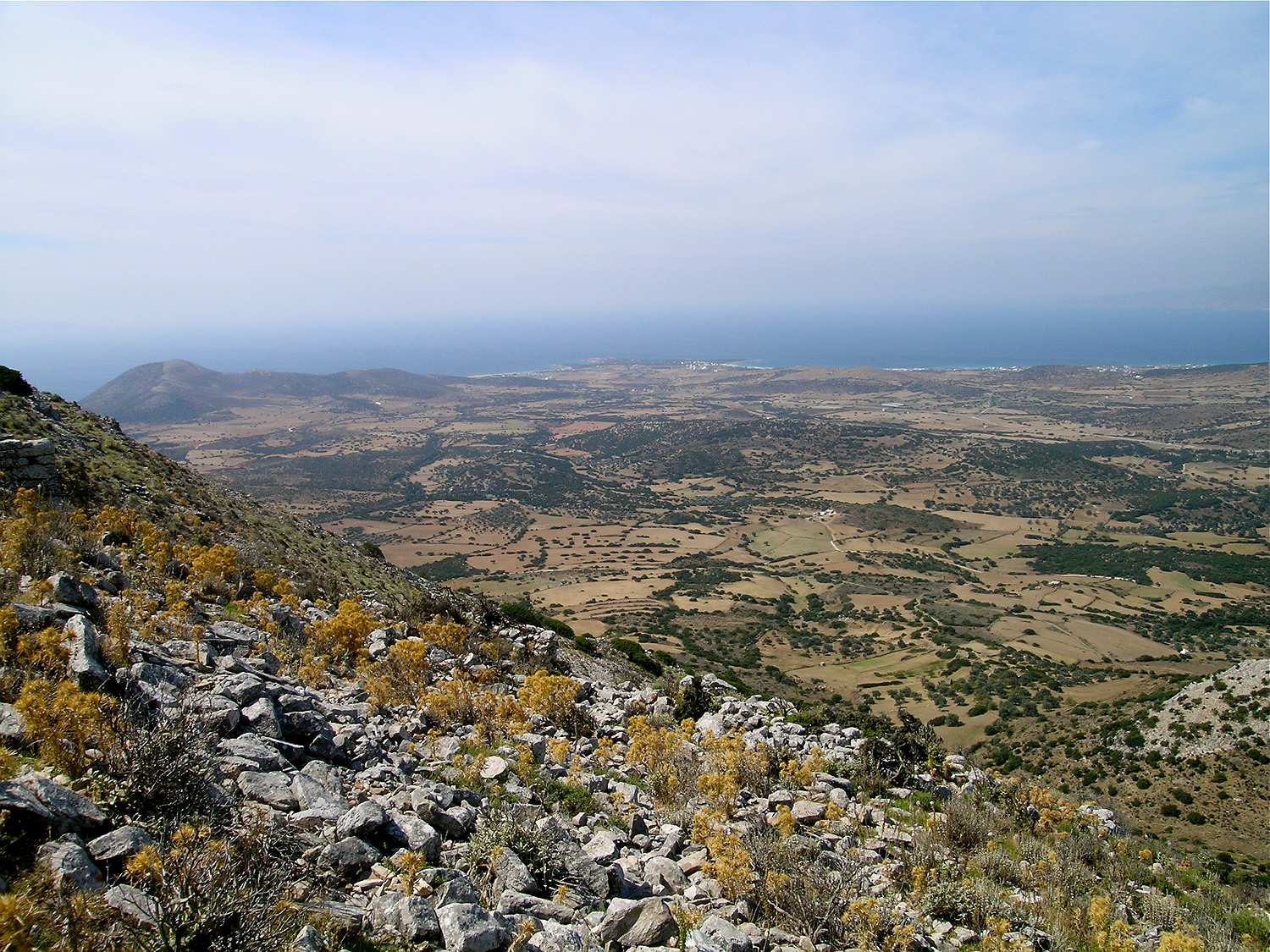
Looking down the ridge towards the south. In the background left lies the bay of Agiassos. On the hill to the right of the bay would probably have been a watch tower to supervise the sea.
We walk back along the east side of the fortress. Right next to the ridge, a wide defensive wall has been preserved. Outside the defensive wall grow some kermes oaks, perhaps the remains of a forest that once grew here.
On the east side, a defensive wall runs along the edge of the summit.
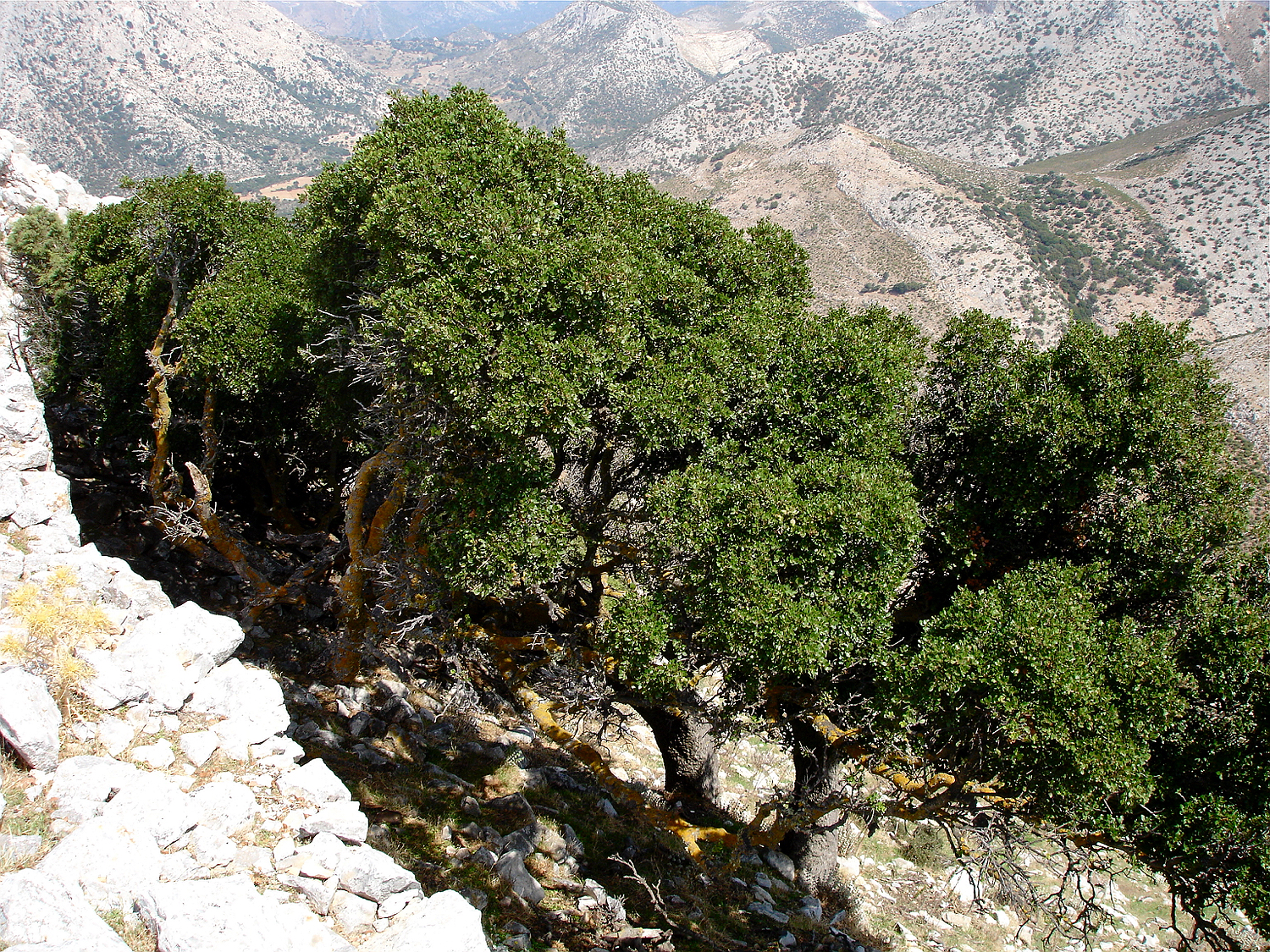
Directly below the defensive wall grow small kermes oaks.
View of the building complex with the churches.
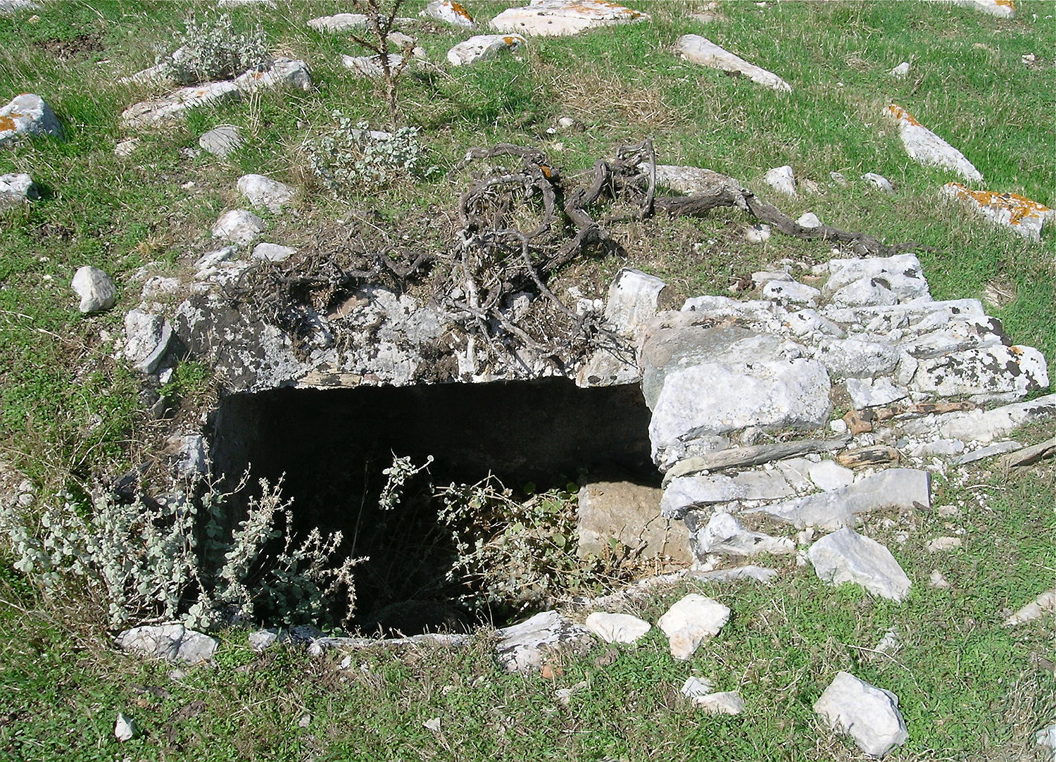
So we come back to the church area. Shortly before the buildings, there is another hole in the ground: again a water cistern. In addition to the stone cisterns that were built above ground, many of the buildings also had their own underground cistern.

While most cisterns are built above ground, there are also some worked into the underground, which lay probably originally under the houses.
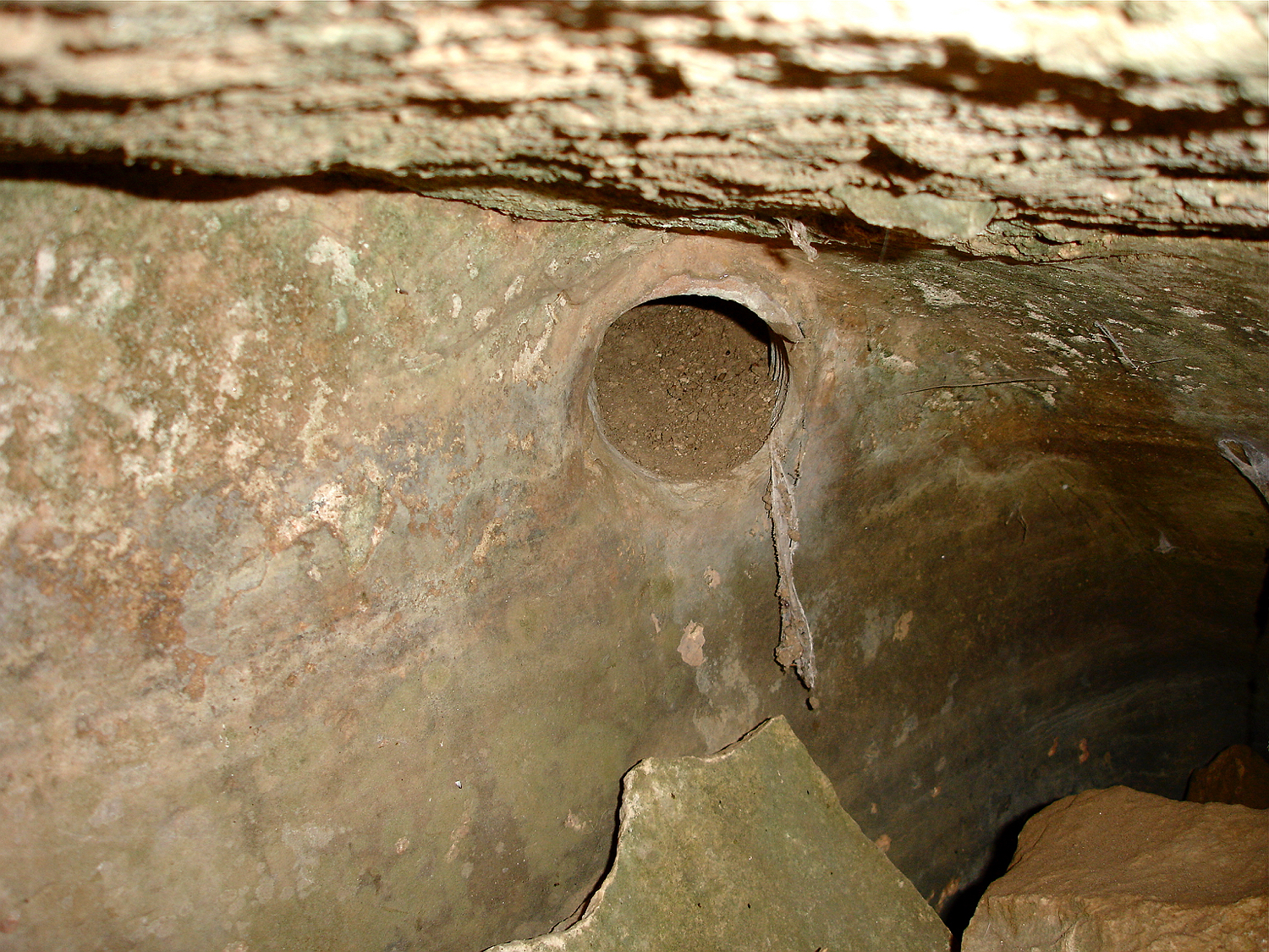
In one corner of the cistern one can see the water inlet.
The roof of this cistern is designed as a barrel vault.
Inside, the cisterns are plastered.
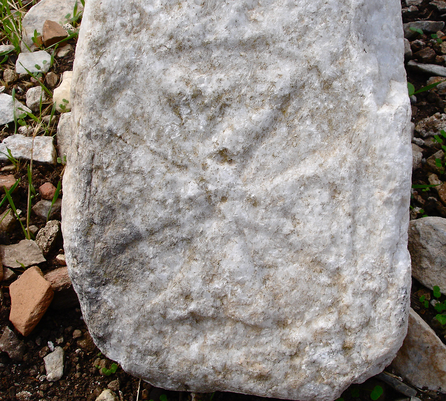
Nearby we find an marble stone which is probably of antique origin. In its oblique sides a cross similar to the Maltese cross is carved. Such crosses were already used in Byzantine art. Similar stones are exhibited in the museum of the Temple of Demeter; they were made of stones of the old temple that were used as chapiters for the small central pillars in the windows of the Byzantine basilica, in which the temple building was converted in the 3rd century AD.
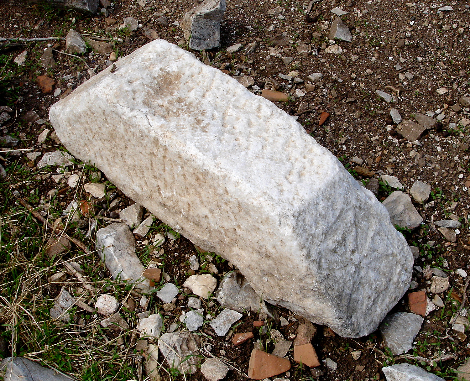
The incised cross on this stone is Byzantine. The stone may originate from the Temple of Demeter; very similar stones were used in the construction of the Byzantine basilica in which the temple was converted. Several such stones are exhibited in the museum belonging to the temple.
Naxos during the Byzantine era
There is no direct written evidence on the Cyclades from the Byzantine period, so our knowledge is limited. The fortress of Apalírou probably dates back to the 7th century; it was obviously used by the inhabitants of the large settlement nearby as a refuge from pirate raids and, together with the nearby harbour of Agiassós, served as a well-protected Byzantine “naval base”. It is important to note that the bay of Agiassós is not a particularly sheltered natural harbour; even on Naxos, an island with few sheltered bays, there are better harbours. So this place was probably used as a harbour because of the existence of the well-defended castle and not the other way round
The Byzantine Empire
The Byzantine Empire was the successor of the eastern part of the Roman Empire and existed from 330 to 1453 AD over more than a thousand years. Not only did it represent the political and cultural continuation of the Roman Empire, but above all it preserved the ancient Greek traditions, philosophy and science, which were later adopted by medieval Europe. It maintained a flourishing trade, a well-organized state and a well-functioning bureaucracy. In spite of continuing struggles with the various neighboring states, especially with “West Rome”, the Western Christian Empire, Byzantium was for a long time the most powerful and richest state in Europe. Capital of the Byzantine Empire was Constantinople, today’s Istanbul. While the empire initially encompassed the entire eastern Mediterranean, including Asia Minor, the Levant, and even Egypt, it gradually lost large areas to its neighbors, eventually being confined to Greece. Byzantium played a crucial role for Europe not only as keeper of the ancient cultural heritage, but also as a defender of the eastern border against the Arabs and later the Turks. Of great importance was the adoption of the Orthodox religion and culture by Russia and its neighbors. The end of the Byzantine Empire was ushered in by the conquest and destruction of Constantinople by the Frankish and Venetian Crusaders, who were called in 1204 by the Byzantine Emperor to help against the Ottomans. Three smaller empires in Greece and Asia Minor continued the tradition of Byzantium; and Constantinople was temporarily liberated. In 1451 though, the capital was conquered by the Turks and the over 1000 years old Byzantine empire came to an end.
Piracy
The very first reference to piracy we know of comes from the Aegean: Greek myths say that the god Dionysus was abducted by Tyrrhenian pirates near the island of Ikaria. According to ancient historians, piracy has been a problem in the Aegean since the beginning of any significant shipping. Already during the Bronze Age it seems that the Cycladic settlements suffered from pirate attacks. During the classical antiquity and the Roman Empire, the rulers succeeded in containing piracy. After that, however, it flourished again, first in the 7th century AD by Arab ships. The Arabs were able to gain control of Crete from 827 to 961 AD, from where they undertook raids throughout the Aegean Sea. It is reported that Arab pirates struck the island of Naxos around 850 AD, and that the Naxians paid tribute to the Arabs. Later, also pirates of other nationalities appeared in the Aegean, such as Turks and Catholic pirates, especially Genoese and Venetians. Even during the Venetian period pirate raids were still a common occurrence. The last raids of pirates in the Aegean Sea took place in the 19th century.
Only a few Cycladic islands have Byzantine fortresses; most castles are Venetian. It seems unlikely that the large Byzantine fortresses were built by the local population for protection against the pirates. Although pirate raids were such a problem that some islands were at times completely abandoned, the inhabitants usually seem to have withdrawn only into the mountains foresaking the harbours and coastal settlements.
The function of the castle as a sentry, refuge and supply point
The castle of Apalírou was probably founded as early as the 7th century (it is likely that an ancient acropolis existed already on the mountain). Around this time the Byzantine rulers built several fortresses along the major sea route from Constantinople to Crete, which also included Naxos. A permanently stationed garrison kept watch over the sea and alerted the neighboring posts and possibly nearby Byzantine ships with smoke and fire signals when danger was imminent. There are reports that the Byzantine fleet was temporarily hiding between the islands of the Cyclades until pirate ships left the area.
The fortresses were also important as supply points because the Byzantine ships had to carry lots of weapons, so that less supplies could be taken. At night the ships were always anchored, and the crews went ashore. The fortress of Apalírou certainly played a role as a supply point especially with its rich hinterland. The fortress however did not have a good view of the sea due to its distance to the shore; accordingly we must assume that there was a watchtower near the bay of Agiassós, that was in sight contact with the Byzantine fortress on Ios, which overlooked a wide area of the sea. Probably there was also a connection to the second Byzantine fortress on Naxos, the small fortress on Mount Kalógeros near Apóllonas in the very north of the island (overlooking the northern sea area), via a small sentinel on the summit of Mávro Voúni in Kóronos.
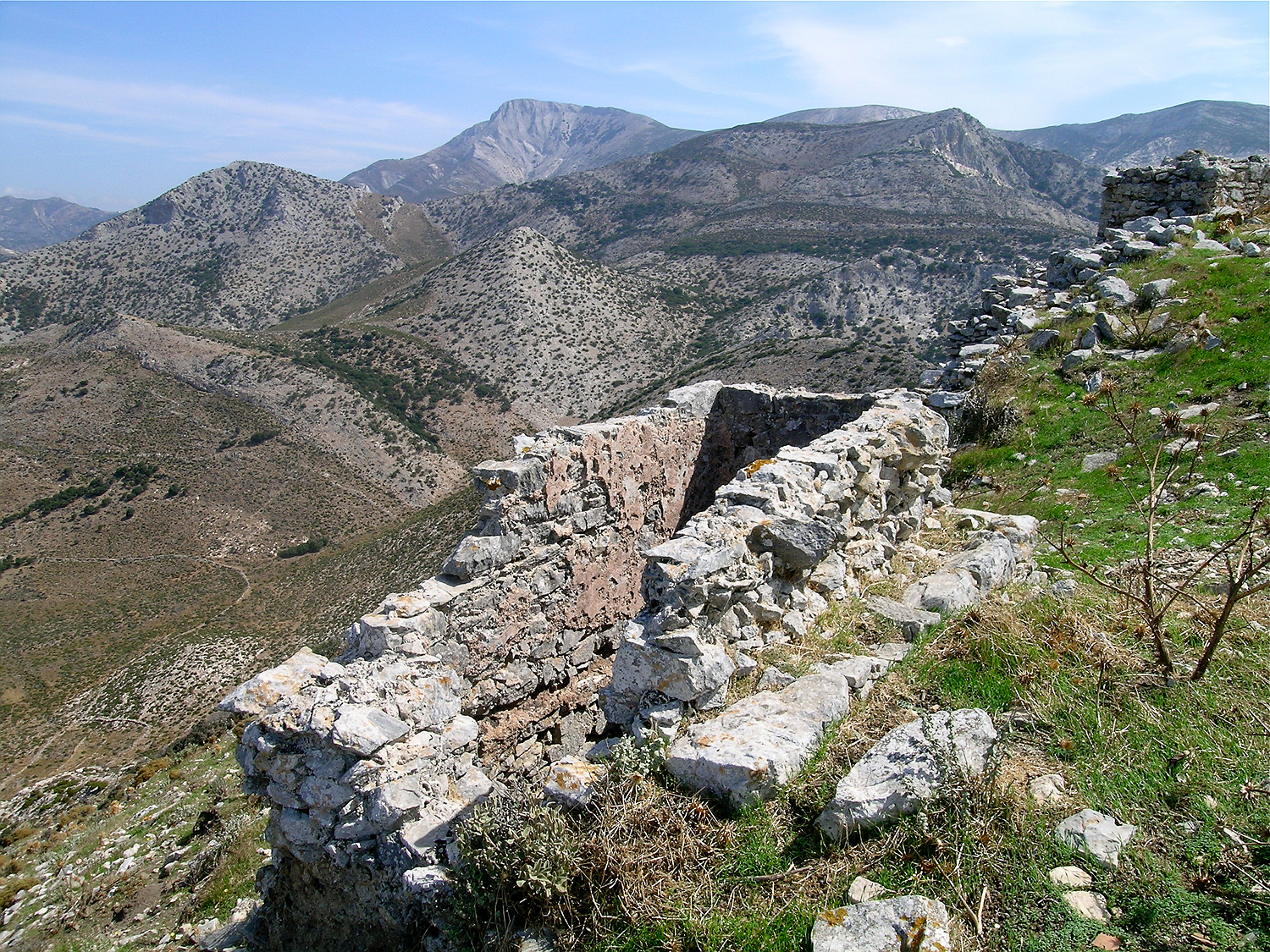
View to the north; on the left in the background the mountain range of Kóronos with its highest peak Mávro Voúni almost in the centre of the picture: from there you have a line of sight to Apalírou as well as to the second Byzantine fortress at Apóllonas.
Apart from its role as a supply port of the Byzantine fleet, the fortress of Apalírou certainly served as a refuge for the population of the area, which at the time was the most densely populated region of Naxos. The number of cisterns in the fortress area proves that the castle was designed to accommodate a large population for an extended siege.
The destruction of the castle of Apalírou
In 1207 (after the bloody and catastrophic conquest of Constantinople by the crusaders in the Fourth Crusade), the Venetian Marco Sanudo approached the island of Naxos with the aim of gaining control of the Cyclades. The population of the area withdrew to the fortress of Apalírou, together with Genoese pirates, who had conquered the island and ruled over Naxos at that time. Marco Sanudo burned his ships after the landing to make a retreat impossible, and took the fortress and thus the island after a siege of several weeks. Afterwards, according to old reports, Marco Sanudo destroyed the fortress, which meant the end for the castle of Apalírou, and relocated the main settlement to the Chóra.
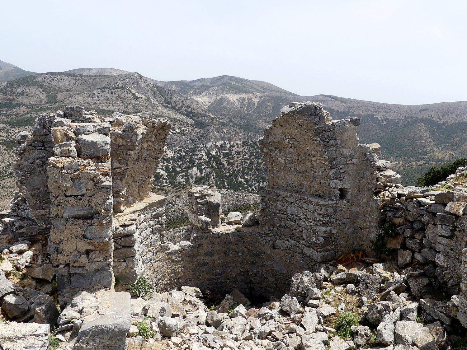
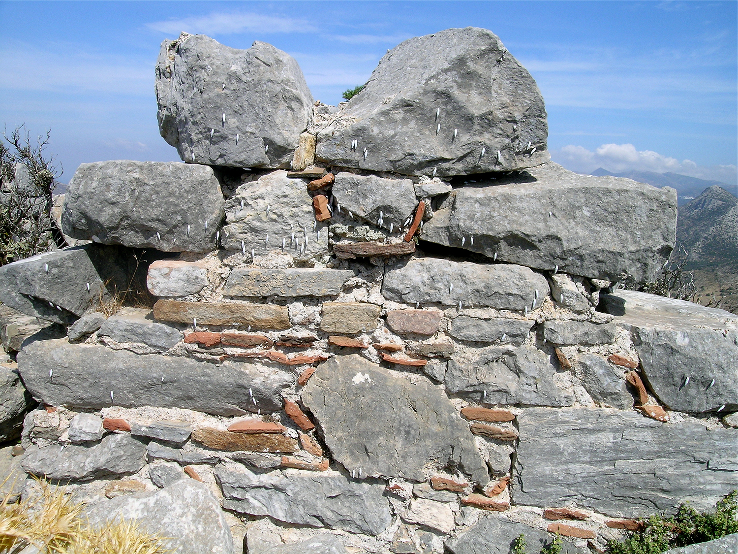
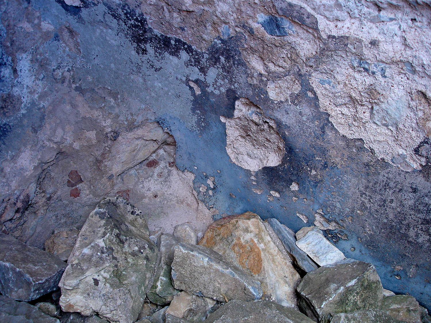
The castle of Apalírou was destroyed by its conquerors to make it once and for all uninhabitable. An effective measure to this goal was the destruction of the cisterns. On the picture you can see the large breaches that were made for that purpose.
View to the north from the castle of Apalírou. On the left in the background lies the mountain of Kóronos with its highest peak, Mávro Voúni, from where you can see both Apalírou and the second Byzantine fortress near Apóllonas.
continue: The Byzantine fortress on Mount Kalogeros
see also:
used literature: Byzantinische Burgen auf den Kykladen, Hannalene Eberhard, in: Jahrbuch der Österreichischen Byzantinistik, Band 36, Wien, 1986